


A cartoon once depicted a car flying into the air off a cliff. The text bubble contained only one word: “Recalculating….”
Although GPS directions are generally not that bad, they can still be dangerous to those of us who follow them slavishly.
I remember a night when I was driving to Dallas, Texas from my old hometown, relying on my GPS unit for directions. It kept asking me to turn left, and then to make a quick right. I eventually realized that its map had not been updated when the road had become a divided highway. It was trying to direct me onto the original road, which happened to be the opposing traffic lanes.
Other than putting in the wrong destination, about the worst thing a person can do with a GPS is to choose the “shortest route” option. Perhaps it should be renamed the “scenic route” option for those who consider rough roads and back streets scenic. It is a good way to find yourself on a dirt power-line road paralleling the freeway you should have been on.
The shortest route option is causing problems for many tourists traveling from Las Vegas to Death Valley National Park.
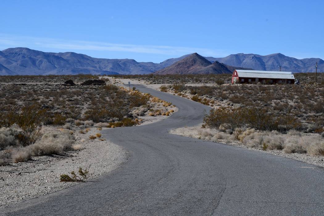
As they approach Beatty on Highway 95, they are directed to turn onto the Beatty Airport Road rather than to continue through Beatty.
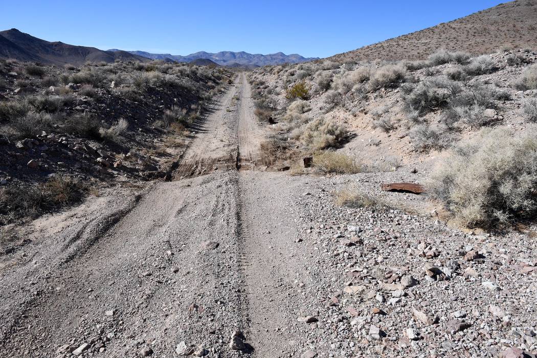
This is not only bad for businesses in the town, which has copyrighted the phrase “Gateway to Death Valley,” but puts them, once they pass the airport, on a dirt road that they find unpleasant at best and dangerous at worst. Visitors frequently complain about the road after having driven it.
Recently there were three accidents in less than two weeks involving tourists using this road. Two of them were collisions with other vehicles when the drivers, realizing they’d just missed the turn, made sudden U-turns in traffic on Highway 95.
The other was a driver using the same GPS-suggested route to go to Las Vegas from Death Valley. That driver saw the turnoff of Highway 374 too late, made the turn at too high a speed, hit the dirt, and rolled.
Long-time Beatty Volunteer Ambulance Service EMT Mark Henderson says that the problem is that drivers are too busy looking at their GPS units and not paying attention to other aspects of driving. These turnoffs are easy to miss, and then the drivers over-react.
His wife, also a volunteer EMT, adds, “Eventually, it’s going to kill somebody.”
Other drivers, unaccustomed to driving on dirt roads, drive too fast on the dirt part of the Airport Road and go off the road on a curve. At least one rental car lost its bumper that way.
The Airport Road problem is not the only GPS-caused problem in the Beatty area. Another involves drivers going from Rhyolite Ghost Town to Death Valley. Often they are directed to take what the GPS and Google Maps call “Pioneer Road,” not to be confused with the Pioneer Road north of Beatty.
This road is paved from where it leaves the road into Rhyolite until it reaches the Red Barn Art Center. Then it turns to dirt.
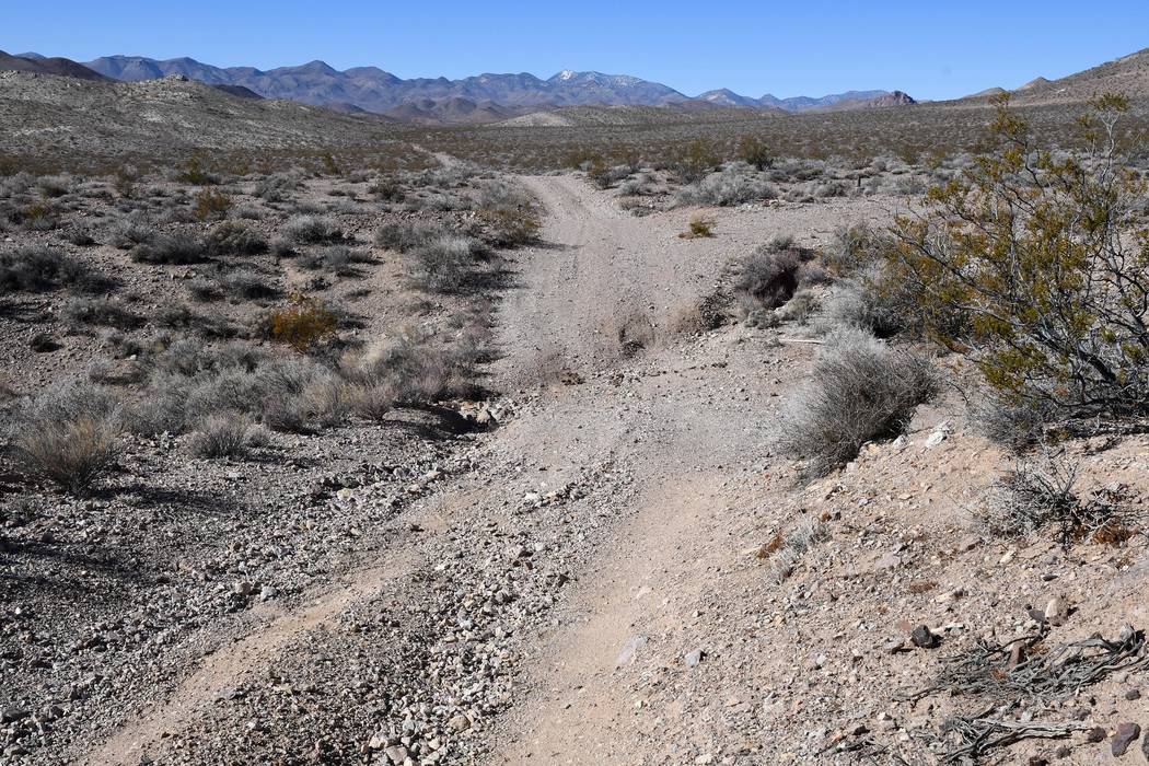
As this road continues west across the desert, it forks many times and becomes increasingly rough. The driver who makes the best choice at the forks winds up following a historic railroad grade. That road has spots best navigated in a high-clearance, preferably 4-wheel-drive vehicle. There are other choices that are much worse.
It is true, that a person can enter the Death Valley National Park boundary on this route, but it is not a viable route to the valley itself. The road also can be very narrow—especially bad news for those who attempt this route in a motorhome.
The county has tried to help with the Airport Road problem by putting up a “Pavement Ends” sign near the entrance to the road off Highway 95, but drivers only see it after they have already turned on the road. Letters to the makers of GPS maps have gone unanswered. The Beatty Town Advisory Board continues to search for solutions.
Richard Stephens is a freelance reporter living in Beatty.