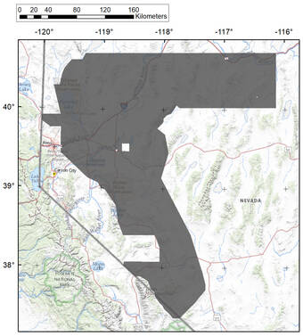
The U.S. Geological Survey is planning to study the western Great Basin as part of an ongoing USGS and U.S. Department of Interior program to gain more of an understanding of the area’s geology, hydrology and natural resources.
As part of the study, the USGS is working to make people aware that the agency will have low-flying aircraft. The flights will occur over western and northern Nevada, more around the Tonopah area, and over eastern California starting on Nov. 1 and will continue through next summer.
“Anyone observing the low-flying plane should not be alarmed when they see it fly over or pass below the horizon,” a release from the USGS said. “The airplane is operated by experienced pilots who are specially trained for low-level flying.”
The aircraft that will be used in the survey will be operated by EDCON-PRJ of Denver, Colorado. EDCON is working with the Federal Aviation Administration to ensure flights are in accordance with U.S. law.
The aircraft will have instruments on board that measure the earth’s naturally occurring magnetic field and natural radiation. This data will help geologists map, model and discern the rock layers at the surface and below.
The USGS says that the instrumentation aboard the aircraft is passive and means that it receives and doesn’t emit signals for detection; therefore, this survey poses no health concerns or risks to humans, pets or wildlife.
The survey will cover roughly 20,000 square miles and will include parts of Nye and Esmeralda counties as well as others in Nevada.