Winter ideal time to visit Huber Wash in Zion


Zion National Park is the default destination for many Southern Nevadans who require frequent doses of wilderness, but in winter, snow and ice sometimes make its best-known trails too dangerous to hike. But those in the know can head to the little-used southwestern corner of the park. Extending into lower desert elevations, this section boasts a handful of trails ideal for winter hiking.
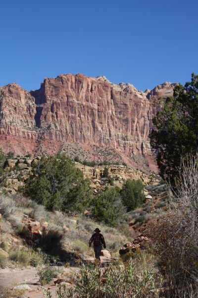
One of my favorites is the Huber Wash Trail, near the base of Mt. Kinesava. On this 4.6-mile round-trip hike, the wash itself serves as your trail except in a few places where you will need to do some easy rock scrambling. The route ends in a box canyon that has hanging gardens and a petrified logjam, both impressive sights well worth the walk.
From the parking pullout pass, located at around 3,750 feet in elevation, pass through the gate on the gravel road, being sure to close it after you. Walk north along the road and drop down into the wash, via one of the obvious paths, then head upstream. The trail enters the Zion park boundary about 0.4 miles from the parking area.
Most of the wash is sandy, making it a good place to look for wildlife tracks. This area is home to desert cottontail, white-tailed antelope ground squirrel, kangaroo rat, gray fox, mule deer, bobcat and mountain lion. You might also see small pieces of petrified wood in the wash. (It is illegal to take any samples, though. If you're tempted, yield not, but think about stopping at one of the rock shops on the main highways; they'll likely have better specimens, legal to buy.)
Continue to follow the wash until all easy progress is blocked by a box canyon. Usually at this point you will be standing at the base of a dry waterfall. There is always some water seepage though and this time of year the canyon is often filled with icicles as it doesn't see much sun. The seepage is also responsible for the hanging gardens of water-loving plants, which you wouldn't otherwise expect to find in this desert environment, thriving on the rock faces.
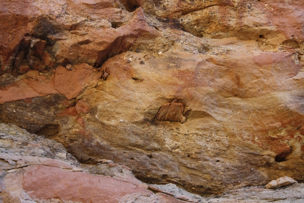
If you look up on your right, you will see several petrified logs sticking out of the canyon wall.
If you have the time and motivation you can extend this hike upstream. The easiest way to do this is backtracking about 50 yards or so and scrambling up the boulders on the north side of the wash. There is one short, narrow chimney section here, so you will have to remove your backpack to wriggle your way through it.
During or after rain or snow the wash becomes muddy and slippery, so it is best to save this hike for a dryer time. Also, the soils in this region tend to be cryptobiotic, meaning they are filled with living organisms and chemical activity and a single thoughtless footstep can interrupt that activity for dozens of years. So be sure to stay in the wash the entire time unless there is already a worn path around obstacles like boulders or cascades. Just one footprint can take dozens of years to repair.
If you are interested in winter backpacking, other good choices in this region of the park include the nearby Coalpits Wash and the Scroggins Wash trails. This region offers a level of solitude rarely found in the rest of the park. There are designated campsites in this area and you will need to get a permit at the Zion Canyon Visitor Center the day before or the day of your camping, or on the Internet in advance, at www.nps.gov/zion/ . The phone number for Zion National Park is (435) 772-3256.
Directions to Zion
From Pahrump take NV-160 south for about 52 miles to Las Vegas.
Merge onto I-15 north and drive for about 135 miles (passing through Arizona) to Utah Route 9 (Exit 16- Hurricane/Zion National Park).
Follow Route 9 east for 32 miles to Springdale, Utah and Zion National Park.
Directions to Huber Wash
From the main entrance of Zion National Park just outside of Springdale, Utah, drive west (retracing your steps, assuming you will be stopping at the Zion Canyon Visitor Center first) on Utah Highway 9 about six miles, to the pullout and gate on the right (north) side of the road.
The trailhead is not signed, but you can recognize the place by the presence of a small transformer station and power lines.
Deborah Wall is the author of "Base Camp Las Vegas, Hiking the Southwestern States," "Great Hikes, A Cerca Country Guide," and co-author of "Access For All, Touring the Southwest with Limited Mobility." Wall can be reached at Deborabus@aol.com.