NDOT narrows down northern Interstate 11 routes
The Nevada Department of Transportation has reduced the number of potential routes for Interstate 11’s northern path from five down to two.
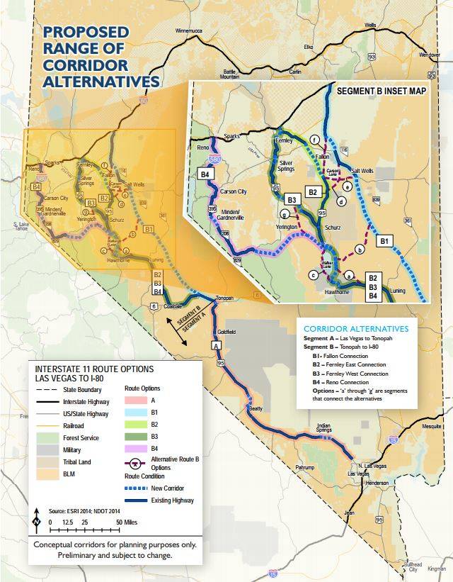
Both the potential routes run north of Tonopah and near the Fernley area up to Interstate 80, maps from the Nevada Department of Transportation show.
The two out of five potential routes that were under consideration for Interstate 11’s northern portion of the future four-lane divided highway system, in what NDOT calls Segment B, will both head through Schurz. From there, one possibility heads toward Fallon and the other could run through Silver Springs before heading up to Interstate 80.
“For segment B, from Tonopah to I-80, we will be making recommendations that B2 and B3 move forward,” said Project Manager Kevin Verre in an email. “For segment A, from North of Las Vegas to Tonopah we will recommend that A1 moves forward.”
In its Interstate 11 Northern Nevada Alternatives Analysis study that was launched earlier this year, NDOT had initially named four potential routes that started in Tonopah and headed north; those alternatives were dubbed B1 through B4. After a series of public meetings were held in March, NDOT added an additional route for consideration, B5, based on public comments the agency received from those meetings.
NDOT’s study also contains Segment A, which had only one potential route that runs from the northern portion of the Las Vegas Valley and along U.S. Highway 95 to Tonopah.
Not all parties are satisfied with the recommendation plans.
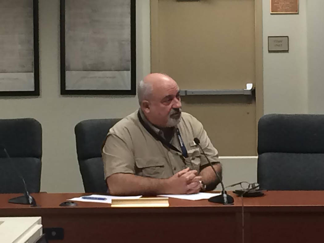
Darrell Lacy, director of Nye County Natural Resources and Federal Facilities, said he is looking to ask for the B1 alternative route to continue to be considered into the next stage of planning for I-11: the NEPA (National Environmental Policy Act) process.
Lacy gave a presentation on where things stand with I-11 during a Nye County Regional Transportation Commission meeting in mid-August.
According to the study underway by NDOT, the B1 alternative route runs from Tonopah to the north through Salt Wells, bypassing Fallon from the east, and then heads up to Interstate 80.
But that route is one of three that are off the table, according to NDOT.
“The corridors that we are not recommending will no longer be considered for the future I-11,” he said. “These corridors still have significant importance to the state, but not as the future I-11.”
Verre stated that the purpose of the study is to start eliminating possible corridors for I-11.
“We are recommending that B1 will not move forward based on our analysis,” he said. “This study will inform future NEPA efforts, so no, B1 will not be considered in future efforts to move I-11 forward.”
NDOT study and I-11 history
The March meeting brought out over 400 attendees for six meetings held across the state, which included input from the public, resource agencies and jurisdictional agencies. NDOT noted 60 written comments were made from those meetings.
A second set of meetings occurred at the end of July and through a portion of August on the 450-mile planned corridor in Nevada.
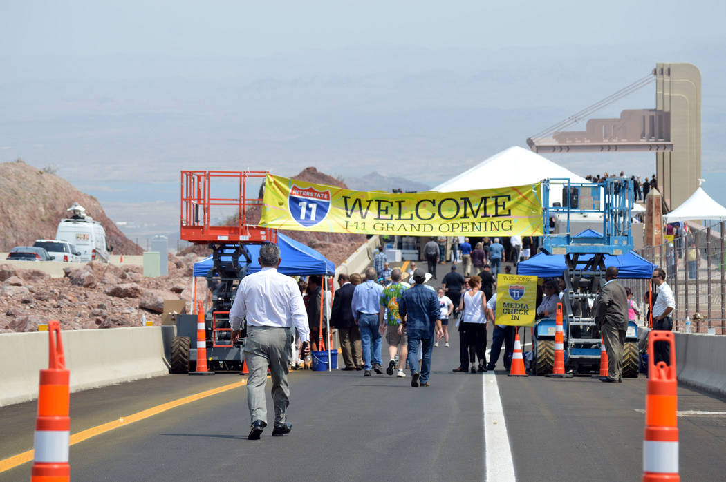
Some portions of I-11 have already opened in Southern Nevada in the Boulder City area.
Overall, I-11 is a project with roots to increase international trade by federal regulators.
Congress took action in the 1990s to boost trade between the U.S., Canada and Mexico. At that time, Congress worked to designate high-priority corridors in the Intermountain West area, according to NDOT.
“The 1991 Intermodal Surface Transportation Efficiency Act and 1995 National Highway Systems Designation Act identified a series of high-priority corridors for federal funding, including the Canada, U.S., Mexico (CANAMEX) trade corridor. This designation recognizes the importance of the CANAMEX corridor to the U.S. economy, defense and mobility,” according to information on i11study.com
The actions of Congress over the past several years have developed into I-11, which is set to begin in Mexico and run through portions of Arizona, Nevada and up toward Canada.
In 2012, the I-11 route from Phoenix to Las Vegas was designated by Congress in the Moving Ahead for Progress in the 21st Century Act (MAP-21). The designation was later extended to Nogales, Arizona to the south and from Las Vegas up to Interstate 80 under the Fixing America’s Surface Transportation (FAST) Act in 2015.
The FAST Act did not include funding for I-11.
Under the recent study, NDOT used several factors in a scoring method to choose the recommended routes. Some of the categories NDOT used in its study included community acceptance, modal interrelationships, economic vitality, cost technology and others. A total of nine categories were considered in the study.
In a report from NDOT, the agency stated the reasons why it didn’t choose certain routes.
“B1 included environmental impacts, lack of connectivity, and inconsistency with planned improvements,” the report stated.
Route B4 was not chosen due to environmental impacts, high cost and lack of agency/public support, the report stated. And B5 had issues listed, such as longer travel times, inconsistency with planned improvements and environmental impacts were highly likely to occur, according to the report.
In an email, Lacy stated he “felt they (NDOT) did not evaluate our preferred route B1 appropriately. Two of the benefits for the B1 route, shorter time and less conflicts with private land and ecologically sensitive areas, do not show up with positive ratings in their analysis.”
“The issues where NDOT seemed to give a lower rating to B1 was the fact that our route does not have an existing state highway and very few people live along this route,” Lacy said. “The constructability also played into this, without funding to build the road means they will expand small segments of the existing state highway as funds become available over the next few decades. Following an existing route is the only way to get this done.”
The I-11 project in not going to be built anytime soon, but Lacy thinks the county should stay proactive.
“This is just the planning stage, we’re probably looking at least 30 to 50 years before Interstate 11 opens for use,” he said during the meeting county transportation meeting. “But I encourage Nye County to participate and be involved proactively at this stage, because once the decisions are made, it’s very difficult to change the routes.”
Also at that meeting, Lacy spoke about bringing back ideas for potential routes going through towns such as Beatty and Tonopah.
NDOT hasn’t yet concluded how I-11 will move along U.S. Highway 95 and through places like Beatty and Tonopah.
Verre told a reporter with the Pahrump Valley Times at NDOT’s March meeting in Las Vegas that those plans were beyond the scope of the process that was in motion at that time. Those details are taken up during the NEPA process, he explained.
The public comment period closes on Aug. 31, 2018. Comments can be sent to Kevin Verre at Kverre@dot.nv.gov
Contact reporter Jeffrey Meehan at jmeehan@pvtimes.com
A closer look
- The Nevada Department of Transportation has narrowed the number of alternative routes from five to two in the northern portion of Interstate 11 between Tonopah an Interstate 80.
- Both potential routes will head toward Interstate 80 from Tonopah and pass through the Fernley area.
- To submit a comment, contact Kevin Verre by email at kverre@dot.nv.gov or by mail at Nevada Department of Transportation, 1263 S. Stewart St., Carson City, NV 89712.
- A public comment period on potential routes for northern portion of Interstate 11 is set to close on Aug. 31, 2018.
Source: Nevada Department of Transportation


